
What a great trip this turned out to be. Just over twenty assembled at the Horrock’s Fold car park (which is just off Scout Road leading to Belmont), on a day when nobody seemed to know what the weather was going to be like (some in tee shirts, some in all weather gear). Derek Cartwright our guided, who took us around the Anglezarke sites last year, was ably assisted this year by Garry Rhodes. Garry for many years was a member of Bolton’s Mountain Rescue group and is somebody who knows the these hills like the back of his hand.
As we struck out across the moors the first things we came across were the stone quarries used now by Bolton Gun Club for their Pistol and Rifle shooting ranges (climbers also use the quarries when the Club is not active).
Climbing further up onto the moors we were welcomed by a light drizzle.  By the time we reached the top of Wimberry Hill the drizzle became more intense making some of us wish we had been better prepared.
Not far to the south of the summit we reached the main subject of our walk i.e. the Wimberry Hill tunnel; specifically its south entrance. Although the entrance was barely visibly in the undergrowth, we could see that the tunnel was over a metre wide but less than a metre deep, suggesting it wasn’t meant for people to use.  We could also see that it had dry stone side walls and large flat stone slabs for the roof. This suggests it was constructed by cutting a trench in the hillside then backfilling producing a ridge about a metre above it.
A recent survey by Andy Hall and Boyd Harris, has revealed the tunnel stretches for 56 metres along the hillside and is now blocked up on its northern entrance. It has no internal chambers and is roughly level with no holes, depressions or other changes in the floor. The tunnel is not straight having two 45o bends, first to the right then to the left. It also does not appear to be connected to any other structure and Derek said it always appears to be dry with all local water courses and moorland drains running well below its level.  The tunnel does not appear on any maps and despite a good deal of research nobody has been able to establish its purpose. Derek is calling it a souterrain having seen similar ones in Scotland. These though are much shorter and always associated with Iron Age settlements (their actual purpose has also never been fully understood).
After a good deal of pondering it was time to move on. We arrived at our next feature just a short distance away to the southwest. This was the reservoir constructed in the 19th century for the Dean Mills about a mile and a half away down the valley at Barrow Bridge (it’s one of two, the second is now dry having been breached in the 19th century). This one though is apparently popular with wild swimmers sometimes having to break the ice to get in.  At this point, the incessant rain was taking its toll and the decision was made to split the team; the more intrepid, led by Garry, would carry on with the tour while the rest, guided by Derek, would return to the car park via Coal Pit Lane.
The valiant few carried on undaunted, skirting around the north side of the reservoir to join the track on the other side of the old boundary ditch known as Dean Ditch. On reaching the next summit (Counting Hill) the rain had eased and, despite its height, a depression in the hillside provided some shelter, enough anyway for a quick lunch break. 
Our next site was something Garry was keen to get our opinion on. Ostensibly it’s a shallow stone quarry but certain features don’t necessarily fit this interpretation. At least two of the large stones were set vertically in the ground and I had to admit the arrangement of others were reminiscent of the Pikestones monument on Anglezarke.  Garry pointed out that the sites we are seeing today became more visible due to the recent moorland fires, the bright green moss now showing being new growth on the bare soil.
Our next enigmatic feature on our journey was a small pond, its peculiarity being the large stones places around it. Garry was sure it wasn’t the result of mining as the pond proved to be quite shallow in a recent dry spell. 
We eventually arrived at the TV mast were work was being carried out to replace the huge cable stays. Garry mentioned that originally there was an internal lift (or hoist) for people to get to the top of the mast but now surprisingly a cage is used hoisted up on one of the cable stays.  Garry had been telling us as we walked about all the various aircraft that had crashed on the moors over the years. The one that stuck in the mind was the plight of two hurricanes that collided at height over the moors during the War. Neither of the two pilots survived.
Nearby we passed the stump dedicated to the Scotsman who was ‘barbarously murdered’ on the moors in 1838 (the original stump being replaced at point by a flange ended cast iron pipe).
In 2020 Eric and I came looking for the source of the River Douglas in this area and found what we believed to be it a short distance to the west of the TV mast. The spring fed a stream which led under a concrete bridge giving access to one of the anchor points for the cable stays.  As Eric and I travelled back towards the Pike we came across evidence of mining activity. This we found strange as, although coal mining on the moors is well documented on Smithills Moor on the south side of Winter Hill, nothing has been recorded in this area (you can read more about this trip here).
As we passed the array of telecommunication masts, Garry gave us a brief history explaining the site’s development when a duplicate underground control system was constructed in the unpredictable times during the Cold War. 
The actual summit of Winter Hill is just a short distance to the northwest on the masts and is marked by a trig station. These stations are now not in use and many have been sold off -this one however has not. 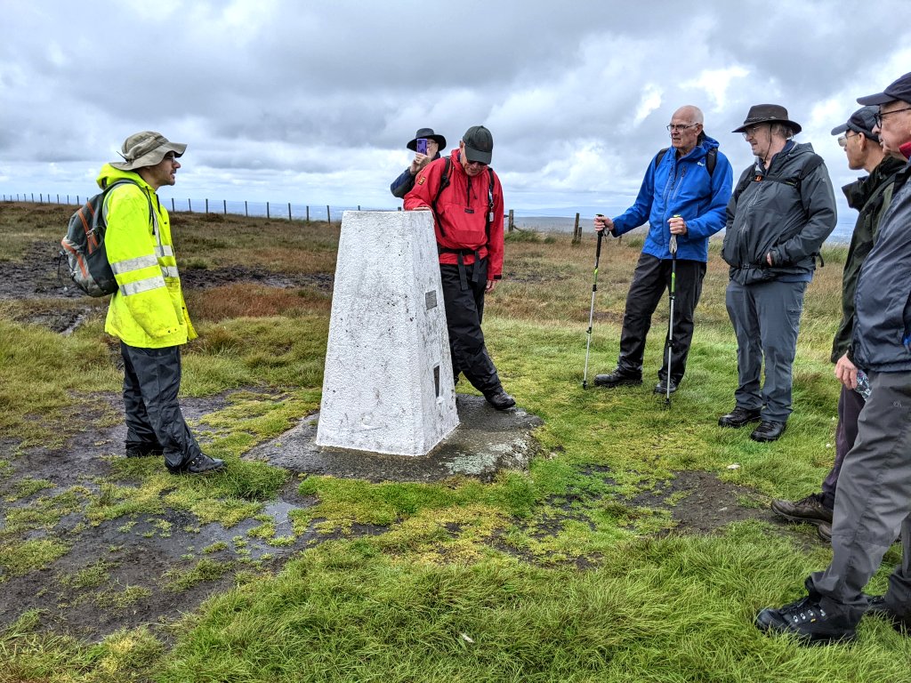
The misty murky weather had now cleared and, looking to the north over Belmont Road, Great Hill on Anglezarke could clearly be seen in the distance. To its right, the mound of Round Loaf was just visible (red arrow). In the middle distance is an are called Will Narr where a sign post marks the source of the River Yarrow (yellow arrow).  During the War, this area was used as an aerial decoy similar to a larger one located on the other side of the moors at Brinscall. These were used in an effort to protect the huge ROF factory at Euxton by smoke and fires to convince the Germans they had hit their target. Linear markings in aerial photos and LiDAR images reveal its location on the ground which have confused some people into think there was an ancient site here.
Further along the ridge we eventually arrived at our final destination, the Winter Hill Cairn,. The stones we see today are somebody’s memorial, the previous pile having been unfortunately bulldozed away in the construction of a firebreak created in the emergency to protection of the mast sites. Not such a catastrophe though as this wasn’t the original cairn anyway because the site had been completely excavated in 1960.  The excavation report described it as a composite cairn i.e. a mixture of stones and earth. The original mound was just under 20 metres in diameter and central cairn consisted of large stones in a shallow pit or depression. However any urn or burial had been robbed out. The report goes on to say that the inner mound consisted of turves whereas the peripheral mound was made up of a bank of sand or ‘tipped subsoil’.
Whilst there, we were welcomed by the flypast of the Lancaster Bomber flying back from the Blackpool Air Show.  Whilst there Garry mentioned the invisibility of the ancient monuments on the moors. During the work on our site in Aspull, there has been much discussion about it and it is certainly true that our site can been seen from this monument and others. However I’m not so convinced of its significance as I needed binoculars to find our site as it was almost side on. To me these monuments seemed more likely to be take advantage of the high spots on moors.
Having seen everything there is to see we headed back making along the old miners track. The weather had improved significantly at this point and Garry was able to point out the many instances of subsidence (some in recent years), this painting a vivid picture of the intensive coal mining activity in the 18th and 19th centuries. In fact when the hills were alight in the recent fires, Garry says it wasn’t so much the peat but the waste from the mines that continued burning. 
All in all it was a great trip (we had travelled over seven and a half miles) and I would like to thank, on behalf of the Society, both Derek and Garry for their time and effort. Derek mentioned another trip on Anglezarke encompassing the chambered cairn at Black Coppice and Round Loaf which we may take up later in the year.