Date: Friday May 11th
Having made things right with the farmer earlier in the week, we could start with this project in earnest – and with Andy back from his two month stint on the A14 excavations near Cambridge, we had a good turn out (Andy is now our resident archaeologist). Joining us on site was Christine, Neil, Patrick and Mark. As with our activities last time on this site, we had to spend a lot of time trying to establish our baseline datum. Over the years Roy has placed various bits of plant equipment including ISO containers in our line of sight (this is a problem the Romans must have had when establishing straight line alignments between to non-intervisible points such as over a hill). We know that the Romans used a groma for surveying but how? – was it just trial and error (which is the generally accepted method i.e. guessing a position on the alignment, then readjusting by sighting along string lines until they align in both directions). This cannot work in our case as no where on the alignment are both datum points visible. I decided to experiment and built my self a groma and brought it along to test how effective it was.  In actual fact it proved to be pretty useless particularly in the breezy conditions (maybe I should have used heavier weights on the ends of the strings). However the main problem for me was the fact that there was no fine adjustment – this was surely essential for long distance alignments (the Greeks apparently used a diaopta which was the forerunner to the modern theodolite which had fine adjustment in both pan and tilt).
Anyway, while I busied myself with my surveying exercise, the rest of the team carried out the real business by laying out a trial trench over one of the GPR survey anomalies discovered in the field with the pond in it (this was easy to find as we had used the adjacent fence line as reference). A 2m x 1m trench was marked out and after removing the turf it soon seemed to become evident what the possible cause of the anomaly was.  This was a broad band of cinder and clinker running north south across the trench and the pottery and material coming from it suggested a fairly modern date. This was not what we had hoped for but GPR had suggested the anomaly was deeper in the ground – perhaps 60cm down (maybe we hadn’t reached it yet).
Date: Tuesday 15th May
On site with just Andy and Mike Keulemans who joined us for the first time (he actually lives near Round Moor Farm which is just up the road so it’s quit handy for him). Before Mike arrived, Andy and I had another go at the baseline problem. This time I was determined to establish the right line by climbing on top of the ISO container to place some makers in classic groma fashion. After some ‘messing about’ I was fairly confident I was on the right line.
Anyway getting back to the excavation we were able extending the trench to 2.5m x 2m. This gave us a better idea of the shape of the band of cinder detected last week. The next step was to put a section through to get an idea of its construction. Underneath the cinder, a band of orange clay was revealed, possibly the fill of a ditch.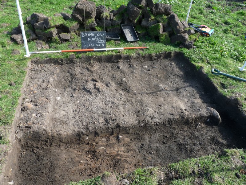
Date: Tuesday 22nd May
Better turnout this week with Trevor Boardman and Dave North joining myself, Andy and Mike. While Mike and Andy proceeded to deepen the trench started last time, I spent some time trying to explain my problem with establishing the baseline to Trevor and Dave (our previous work is locate from it, so quite important). We discussed in depth about the Romans having a similar problem, and in particular, how did they establish accurate long distant alignments between to known positions (to me guesswork would just not be good enough).
Back to the excavations – Mike and Andy soon uncovered what seemed to be the natural soft sandy clay subsurface. This was a lot shallower than expected.  However the surprise was a recently excavated pit on the west side of the trench which contained the remains of an animal – plastic rope around one of the bones proving its recent deposit (the bones size and type suggested a sheep).
  Why it had been buried is unclear but large pieces of lime amongst the remains suggest a diseased animal. We decided therefore not to go any further with excavating this area. While Dave and I returned to the baseline issue (rechecking dimension take from previous visits showed that we still hadn’t got the right line), Andy was given the task of drawing up the section. It became obvious that on the east side of the trench, there appeared to be a filled in ditch.
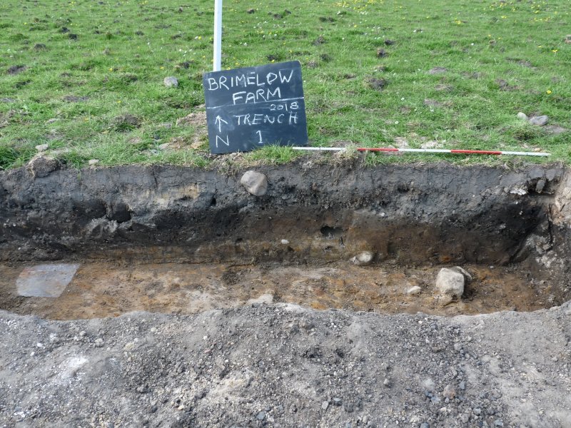 This was right on the edge of trench, which will therefore need further investigated (perhaps on our next visit).
Date: Wednesday 4th July
Just me, Andy and Trevor today with Mark joining after lunch. Last month we devoted our time on our Roman road site (Site 1) but, as it’s been very hot these last few days and the ground has baked hard, it was decided to go back to our original site (trench 1 site 2). Maybe it was time to close it down as we perhaps we had cleaned all the information we could from it. However, looking again at the section (south side this time), it was quite clear that there was a ditch feature on the east side (left in the photo below) and a ridge of natural next to it. there was then a flat bit before it dipped down into the pit where the bones were found. This ditch feature and ridge we thought was worth further investigation.  It was decided therefore to open up a test pit on the other side of the trench to see if the ditch and ridge feature continued. Working in he heat wasn’t very pleasant but I had the presence of mind to bring the gazebo which made all the difference.
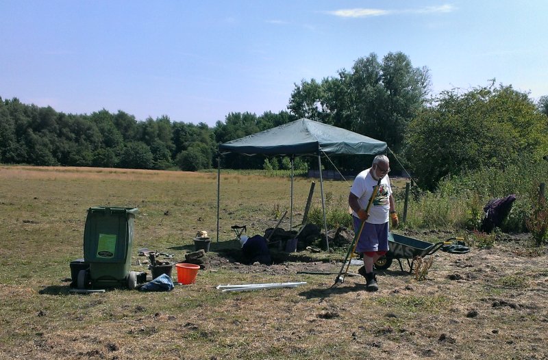
While Trevor busied himself back-filling our first test pit, Andy and I cut a half metre by 1.5 metre section on the south side of the trench. Once below the subsoil, the ditch feature was soon appeared but the ridge was not visible which must the feature is just local to that area.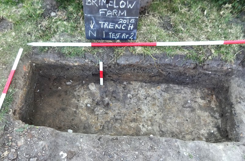
Intrigued by the ditch feature, we decided to extended the test pit half a metre to the west – but with no sign of the end of it, we decided to dig it out. This turned out to be more difficult than we expected as the ditch plummeted down 80cm. It proved difficult to follow the edge of the natural so we undercut feature the in steps. This produced quite an interesting result with at least 4 phases being revealed. Above the natural was a thin layer (3-4cm) of sub-soil, but above that was a thick layer (20cm) of organic soil showing that the ditch had been left open for many years. This feature was filled in in recent times by a mix of clayie material, a piece of plastic tube giving its likely date. This wasn’t the end of it though, as a thin layer of cobbles sealed the surface.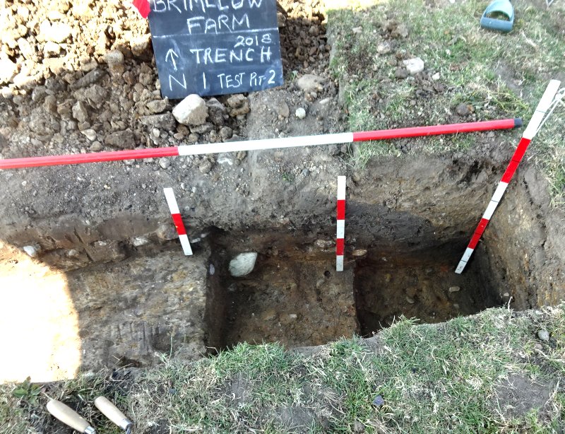 There is a field boundary shown in this vicinity on the early OS maps, so this is the likely explanation for the ditch which must have been open until recent times (unfortunately no finds to date it). We don’t have a date for the farm itself (Porteus in is History of Standish gives it as 17th century) but the field boundary does not respect the line of the Roman road suggesting that the road had disappeared well before the farm had been established.
As the hot weather is drying out the fields, I was hoping to detect the possible parch marks mentioned by Roy the farmer (which initiated our investigation in this field). Couldn’t see what he described but there is a very distinctive rectangular parched parch in this area. It doesn’t correspond to anything found on our GPR survey – maybe a quick section across it would solve the issue.
