Here is our Site Diary detailing our activities on the Kirkless site – as usual with a blog, need to scroll down to the bottom to get the earliest entries.
Date: 22nd November 2015
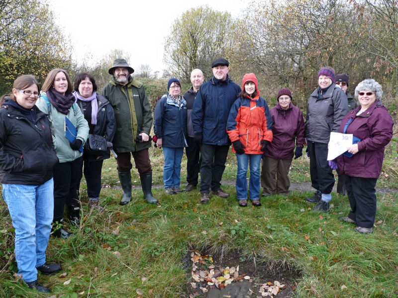
Today was the Heritage Walk day organised by Sue Lonsdale from the Wildlife Trust, for those interested in seeing what we have been doing here. Although our dig licences has expired, we managed borrow the GPR equipment for the day from Sygma Solutions, to see if the system was effective on this type of site. So, while I took the group round the various areas we have been investigating, Darren, Andy and Patrick set up the equipment on the chimney base site. 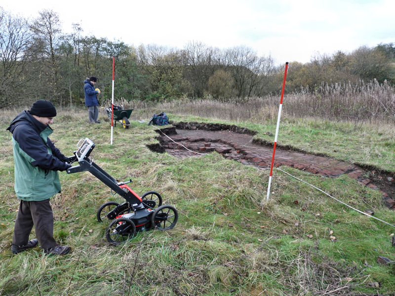 By the time I’d finished the tour, a 10m x 10m survey next to the chimney base had been competed – and the results were very encouraging. At a depth of between 25cm and 75cm, a linear feature was detected projecting in a southeast direction away from the base. Could this be the chimney flue we have been looking for. In the south corner of our survey area there also seems to be a very distinct are of disturbance at a depth of about a metre. This may be rubble but could also be the remains of the the furnace connected with the chimney. Both these features would make great targets for future investigations if we get chance to dig their again. The group were very impressed with our archaeology and were keen to understand more of the history of the site. (may have even encouraged one or two to join us in the future).
Date: 6th November 2015
This Friday afternoon session was organised to coincide with the Wildlife Trust’s field workshop. Myself and Andy had half a dozen or so volunteers from the Friends of Kirkless to help us with our tasks. Both Cheryl Knott and Sue Lonsdale from the Trust were on hand to coordinate activities and soon got tuck in with a bush cutter to clear the southeast end of the southwest concrete wall. On each previous visit we had attempted to clear this end but the brambles had always defeated us and there was even some doubt whether the end had survived at all. The clearance proved successful and the end of the wall was shown to be in good condition.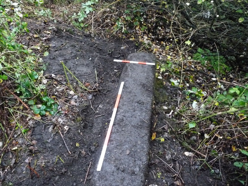 In the meantime one volunteer helped Andy to plan the extent off our excavation of the chimney base – while other volunteers helped with our search of the northwest end of the southwest brick wall. Our previous visit had shown that the wall continued beyond the stanchion discovered in September. Extending the trench dug by Eric last month showed that the brick wall showed no sign of ending.
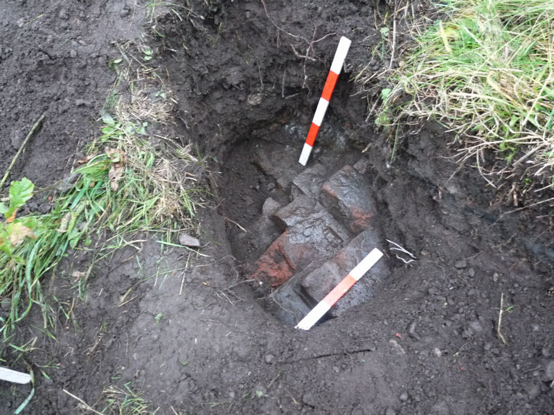 In fact a test pit 1 metre further along proved that the wall continues even beyond this point – albeit at some depth (about 1 metre). Further to the northwest the ground becomes very compacted and so we may not be able to find the end of this wall.
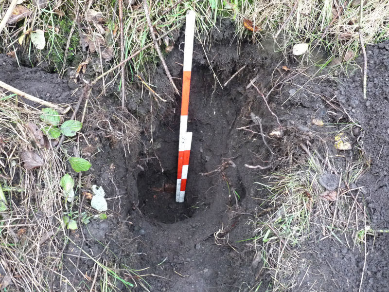 Despite this set back I’m sure the volunteers got a lot out the day and we plan to carry out another session later in the month.
Date: 11th October 2015
Best turnout so far (nine in all including Darren, Andy, Neil, Eric, Ben, myself, two students from Winstanley A Level College (Jennifer and Fin) and young Robert from Whelley). With so many hands available we were able to make some headway on opening up more of the chimney base. 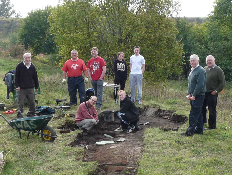 The theory being that the ‘eye’ of the chimney (i.e. where the smoke came in) may still be detectable in the base (if it came in low down it would have been in the form an arch).
 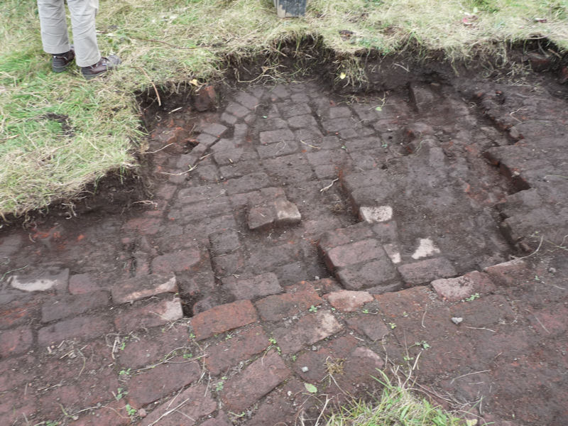 Unfortunately nothing of this nature could be detected despite us clearing enough of the chimney’s centre area. What it did reveal however was that at just one course lower down, the circular area pattern is strangely much larger (if this pattern defines the internal diameter then maybe there was a change of design during its construction).
 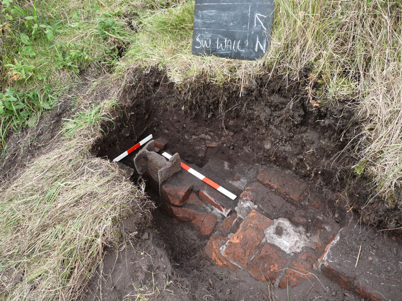 Meanwhile Eric was tasked with opening up the NW end of the SW wall section Andy uncovered last month. Our hope was that this would reveal the termination point of this wall, particularly with there being a stub end of a stanchion at this point.
 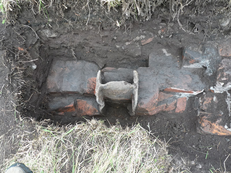 Unfortunately for us more of the wall was uncovered running beyond the stanchion proving that this wasn’t the end of the wall (more work needed).
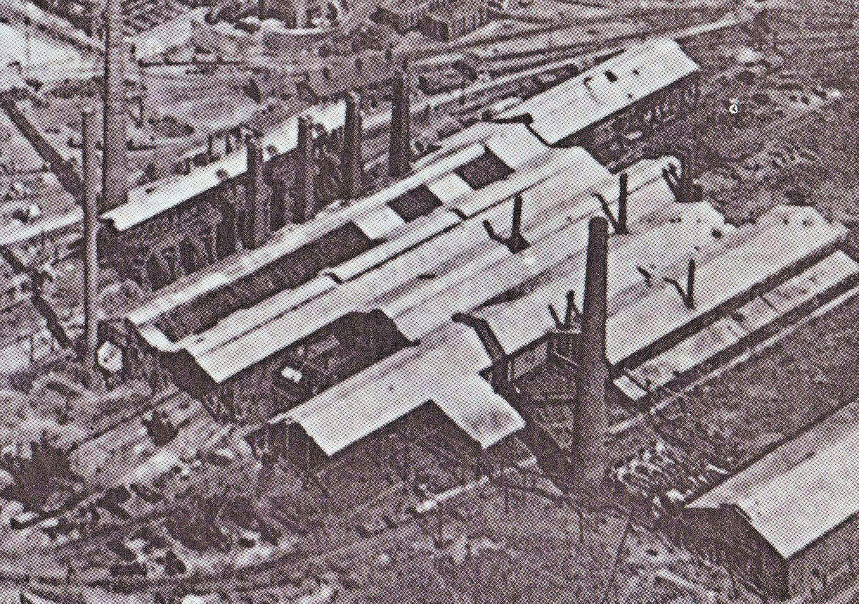
At the other end of the SW brick wall Darren was tasked with confirming the SE termination point (which Ben thought he detected in July). In the meantime Neil and I looked for evidence of a weighbridge which was reported in the same area by one of the local residence. 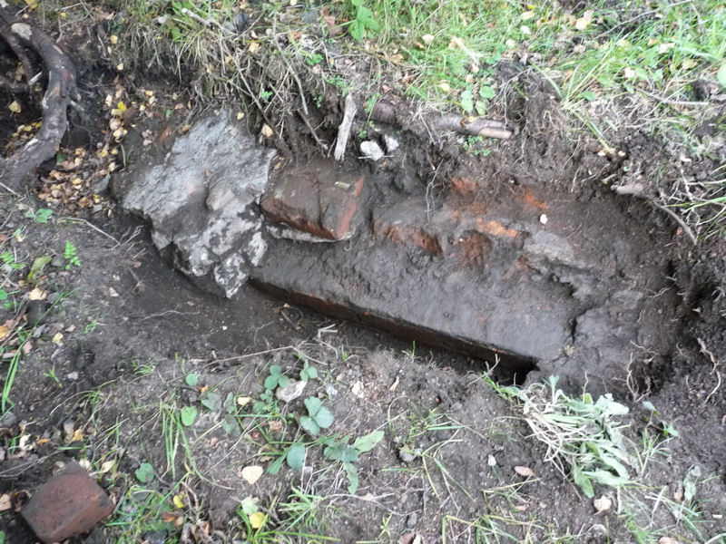 Ben’s termination point turned out not to be so as the wall continues beyond this point disappearing under a layer of concrete, the same concrete which Neil and I had detected further on). Despite these setbacks however we have now been able to establish quite a long section of this wall which appears to be strangely contrary to the profile show on the early maps. A suggestion is that the map indicates the roof profile which probably protruded beyond the floor boundary (which is also suggested by the aerial photo).
Unfortunately the end of the day was marred by a group of youths who were determined to cause bother for us. I don’t think, however, these are typical of the local children who in general have shown interest in what we have been doing.
Date: 13th September 2015
Only three of us this week (me, Darren and Andy). First job was to clear the site of beer cans (looks like late night parties have been held in honor of our excavations). This job completed, Darren concentrated on opening up the circular area at the centre of the chimney base to establish its shape. Inside this area the brick pattern square instead of radial – does this circular area represent the internal diameter of the chimney? If so it would have been 1.84 metres diameter.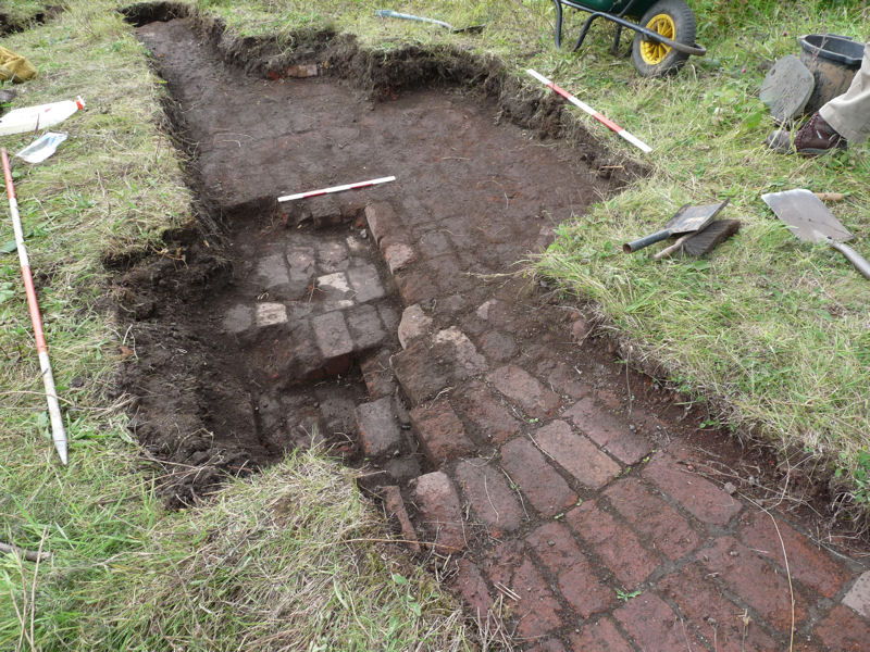 Meanwhile I tried to uncover the stepped brickwork at the southwest end of the trench. This prove to be very difficult with the compacted rubble resisting both spade and mattock – I managed only to extend the trench just a few more terraces before having to give up.
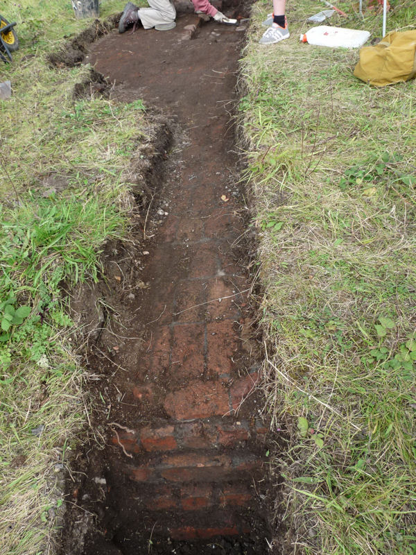 I thought it more fruitful to join Andy who was tasked with trying to find the NW end of the SW brick wall we had previously discovered in Test Pit 5. This also proved very difficult as the soil here was very compacted and with stone inclusions, preventing the spade from penetrating to any depth. After hacking for a while at the overburden with little progress we decided to see we could skip a metre or two. This put us in the area where Patrick had previously investigated without success. However this time we could detect a thin fissure in the soil similar to one we had seen in Test Pit 5 between the face of the brick wall and the soil itself.
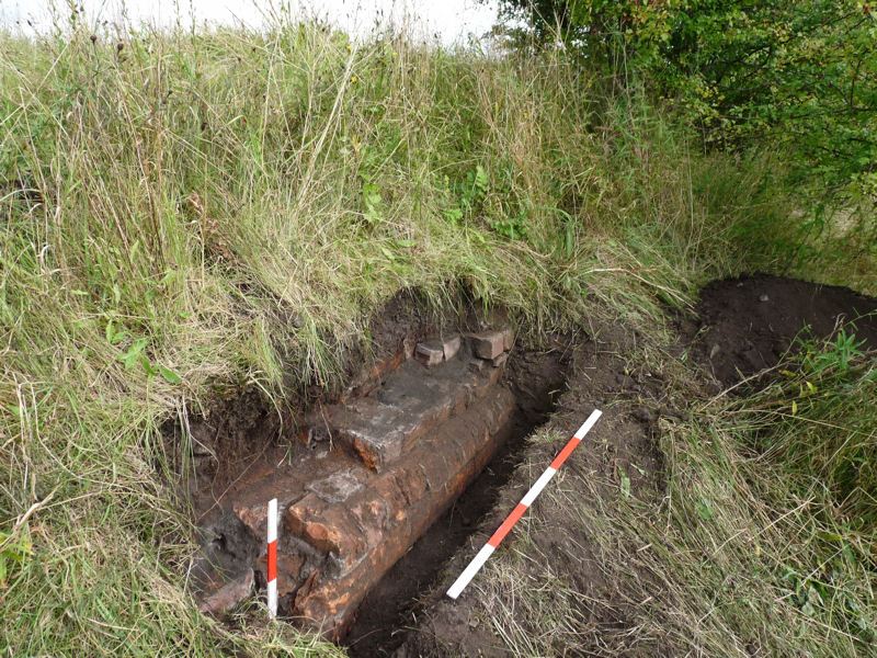 Sure enough brickwork began to appear and this time it displayed foundation courses or plinth with a curved edge – and on the northwest side, at last, signs of the end of this wall with a single stub end of an stanchion found protruding from the ground. The soil here is much softer so I’m sure on our next visit we will be able to confirm this one way or another.
Date: 23rd August 2015
Holidays and bad weather has meant we have only just been able to get back on site but at least the rain has given the exposed brickwork of the chimney base a good cleaning (just four of us today myself, Andy, Darren and Patrick). 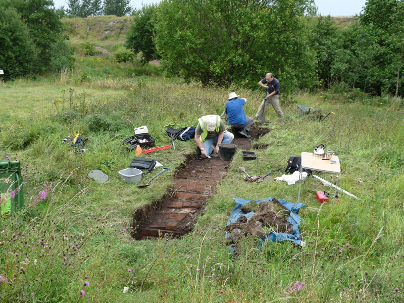 First job was to establish the actual size of the base so the trench was extended until the southwest end appeared. The brickwork at this end has survived in better condition therefore the last course of bricks before it begins to step down is still intact. This is not the case at the other end where damage has occurred, probably during the demolition process, resulting 5 courses being chamfered away.
 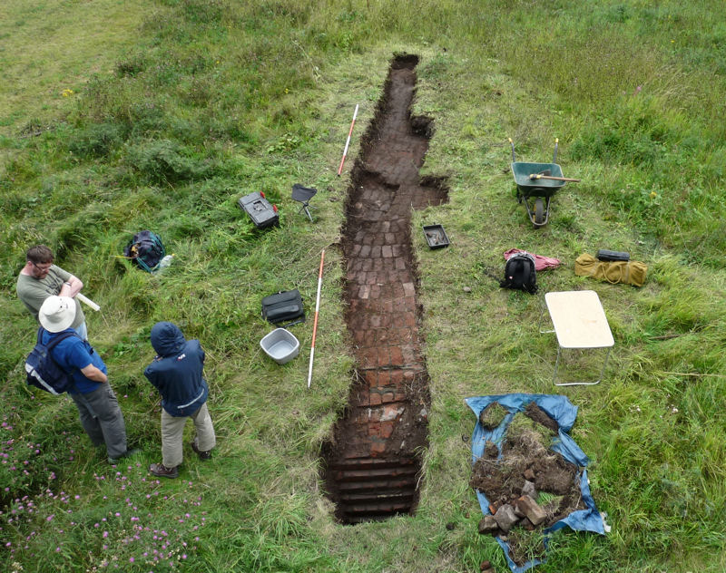 This has made it difficult to measure precisely the diameter of the top of the base but our best estimate is that it is 7.9m (26ft) in diameter. While we were uncovering the base, Andy busied himself getting to the bottom of the stepped brickwork on the northeast side.
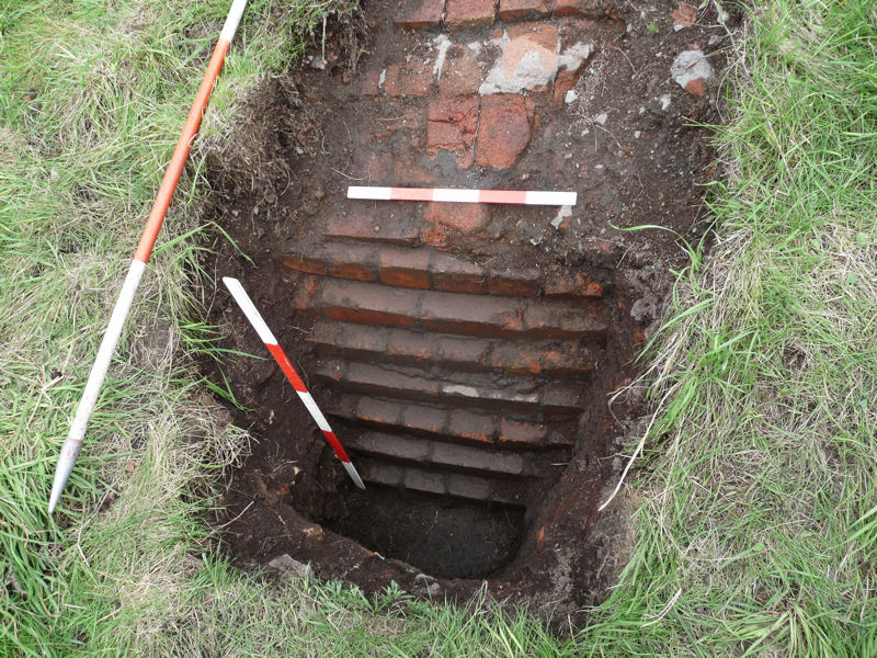 After 7 courses he eventually reached the bottom which seem to consist of a concrete plinth. That makes the base a total of 12 courses high (each brick is 83mm plus 10mm of concrete makes the base 93×12 = 1.1m high (3ft 8in) high).
Date: 12th July 2015
Good turnout this week (myself, Andy, Darren, Neil and new volunteer Ben). After explain the site to Ben, both he and Darren set off to see if they could establish the extent of the southwest wall we uncovered last week in Test Pit 5. It looked as if the wall turned a corner at this point but further digging by Darren revealed that it was just a recess for the stanchions. 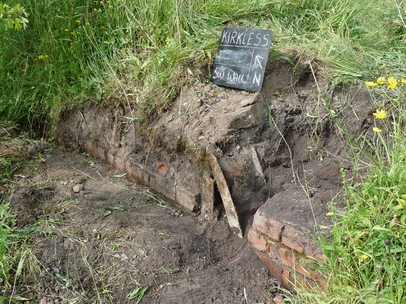 The extent of the wall toward the northwest is still undetermined despite the efforts of Darren and myself. Ben however, persevering in difficult conditions under the trees, finally exposed what seems to be the southeast end of the wall. A tape measure from our baseline confirmed that the end coincides with the northwest end of the concrete wall we discovered in Test Pit 1 at the end of May.
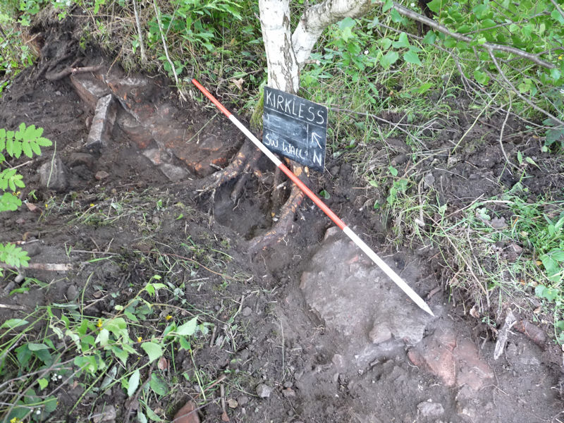 Ben’s wall however is not continuous as a big lump of concrete cuts across it for some reason.
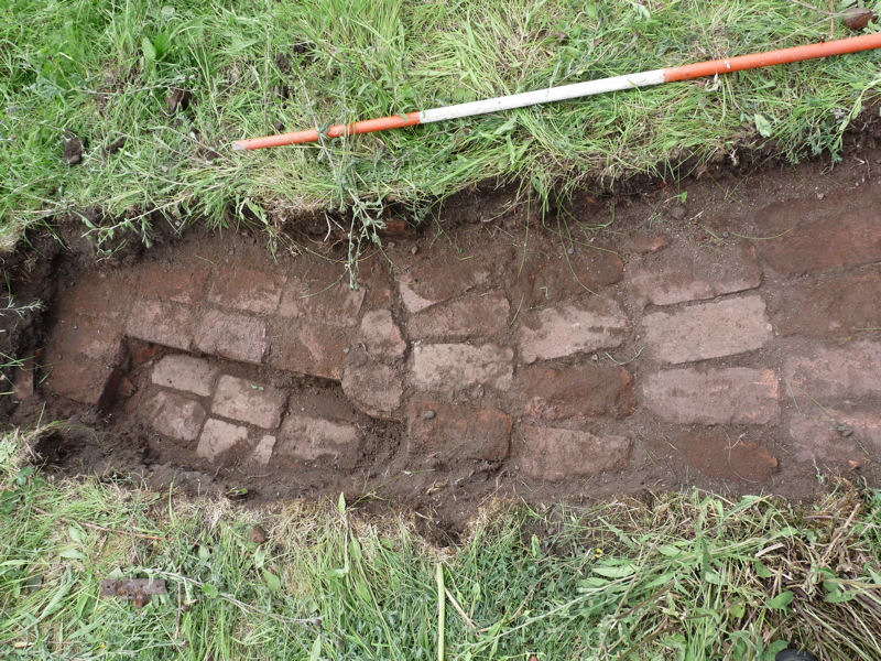
In the meantime the rest of us were busy looking for evidence of a small isolated building shown on the 1922 map to the southwest of the southwest wall. The vegetation is sparse in this area and probing indicates solid structure just below the surface. But is this the building or demolition debris. More to the northwest the sparse vegetation develops into shallow promontory. A spade in the thin turf quickly revealed in-situ brick work which to fall away to the northeast. The end of the wall was soon exposed consisting of series of steps going down at least 7 courses. On close inspection the wall was obviously curved suggesting a circular structure. This could only mean one thing – the base of a chimney.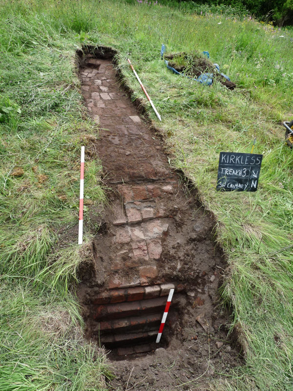 Chasing the brickwork towards the centre of the structure we soon realised that the chimney was a big one. The centre was represented by a circular area, from which we could measure the radius. This turned out to be 4.7m which makes the base 9.4m (or 30 foot) in diameter which is huge.
 Study of the 1920’s aerial photo shows a large chimney in this area. This must be the one we have found which is great news because at last we have a feature with which we can confirm the location of the steelworks.
Date: 4th July 2015
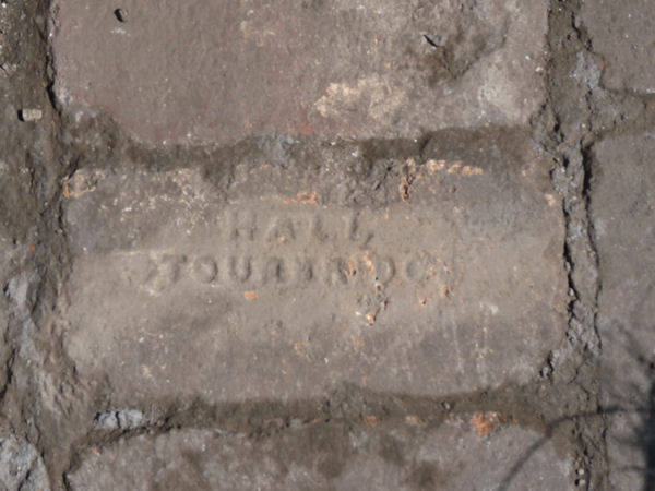
Just three of us today (myself, Andy and Patrick). However we did manage to find the end of the wall we uncovered on our last visit, just short of the footpath. Unfortunately it didn’t have a return to it. It just seemed to peter out, therefore we are still not sure which side the building was on (or if it was a building at all). There is hard compacted material on either side and it also lies under a compacted layer suggesting it was an earlier phase which was abandoned and covered over. Some of the bricks were obviously reused firebricks – stamped with HALL STOURBRIDGE- a company in the West Midlands which was still going up to 2008. 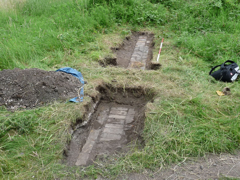 They speciallised in making firebricks for the Glass Industry but their main trade was making fireboxes of Steam Railway Locomotives in the mid to late 19th century.
This week we also had a look at the brick wall which bounds the site on the southwest side. It is exposed to a height of about 1.5 metres in the middle near to where we found the end of the concrete wall. However, going northwest, it disappears into the undergrowth. The high terrace remains all the way to the footpath on the extreme west side but when Patrick put a trench across it, could find no sign of the brick wall – however patches of concrete exposed on the terrace indicates that parts of the factory existed in this area. The footpath on the extreme west side does run over a thick brick wall but on examination this appears to be an isolated structure.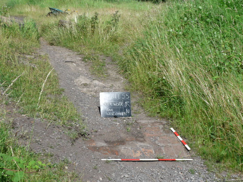 We decided, therefore, to chase the exposed brick wall from its middle position, in a northwest direction. After about 11 metres we came across a return or corner but it was’tn clear whether this was the end of the building or just a recess. Two adjacent upright stanchions (one bent over) suggest the end of a building but further investigations will be needed to confirm this.
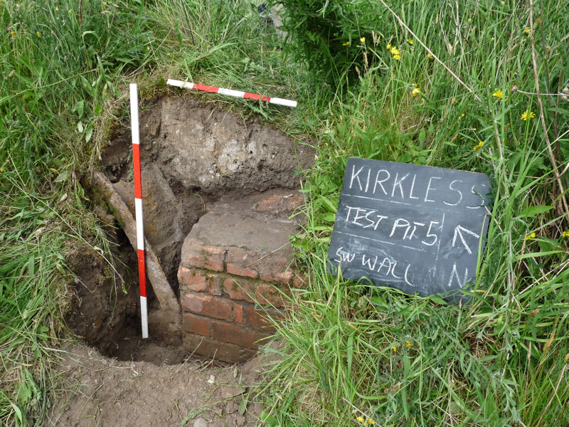 Some fun and games with the local scallies this week running off with our ranging poles and wheel barrow though we managed to retrieve them – the wheel barrow from the slag heaps on the other side of the landfill site.
Date: 21st June 2015
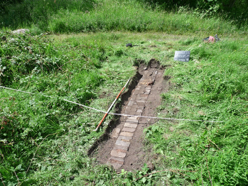
Four again this weekend (myself, Andy, Darren and Neil). Having established the full extent of the pavement building in our Trench 1, we decided to look at how much of the Steel Works had survived on the northeast side. It was becoming clear speaking to local residence that major landscaping had taken place in the 1980’s with huge swaths of the site being bulldozed away. This had resulted with a depression in this area where he expected the factory to be and also the pond on the east side. To find the extent of the destruction, on our last visit, Patrick had started a trench (Test Pit 4) on the edge of what appeared to be the hard surface of the factory floor. This week Darren continued with this trench, persevering in difficult conditions between the tree root and, although not very impressive, it seems like we have found the raggedy edge of the destruction in this area lying about 8.5 metres to the northeast of the pavement.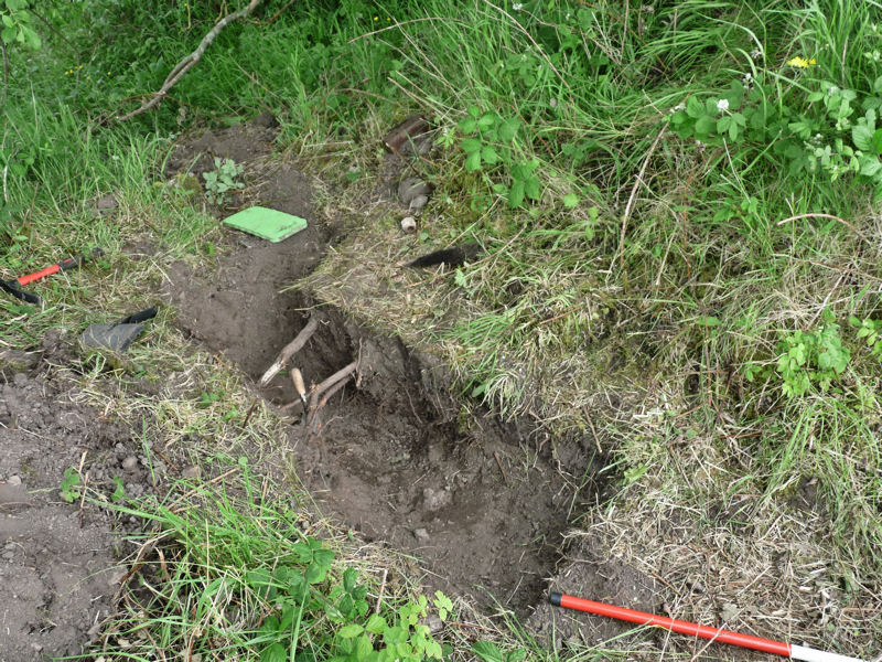 All along this edge it appears that destruction debris has been deliberately deposited to form a bank (maybe to protect the edge from people fall off). Towards the northwest side the bank eventually disappears and the depression get shallower. It was here that we decided to put in another trench (Trench 2) to see if we could find the northwest extent of the site. Luckily our first spade went in on another brick wall which we chased in both directions.
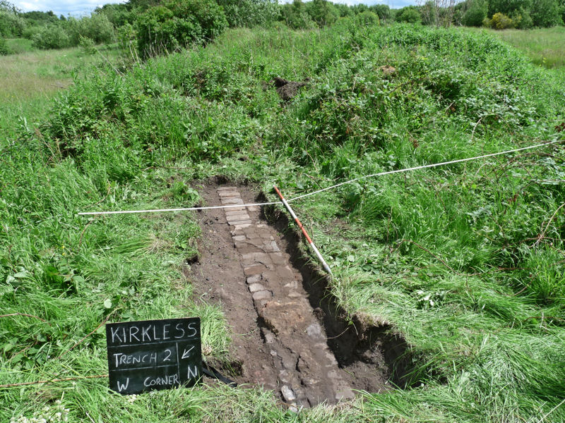 It seemed to be running parallel with the northeast wall of our pavement in Trench 1, offset by 14 metres to the northeast. We couldn’t find the extent of it because of the debris bank on the south side and the path on the north. However, as it lies more than 28 metres to the northwest of the pavement, it suggests the site site was much bigger than we had anticipated on this side.
 The highlight of our visit this week however was the refreshments provided by Darren – i.e. hot tea accompanied by a bacon butty.
Date: 7th June 2015
Four of us this weekend (myself, Andy, Darren and Patrick) – although Neil also paid a visit later with his dodgy ankle (providing a supervisory roll). Our first task was to establish the extent of the walling which encloses he pavement on each side. We know it extends towards the southwest but not how much. In both cases it turned out to be not very far and there does not appear to be any interconnecting wall an the southwest side. This suggests that building would have been open on this side. We also opened up the opposite end of the southeast wall which showed that it was very similar to the north corner of the northwest wall having a small detached brick plinth. This is suggestive of a support for some sort of structure on the northeast side of the building. 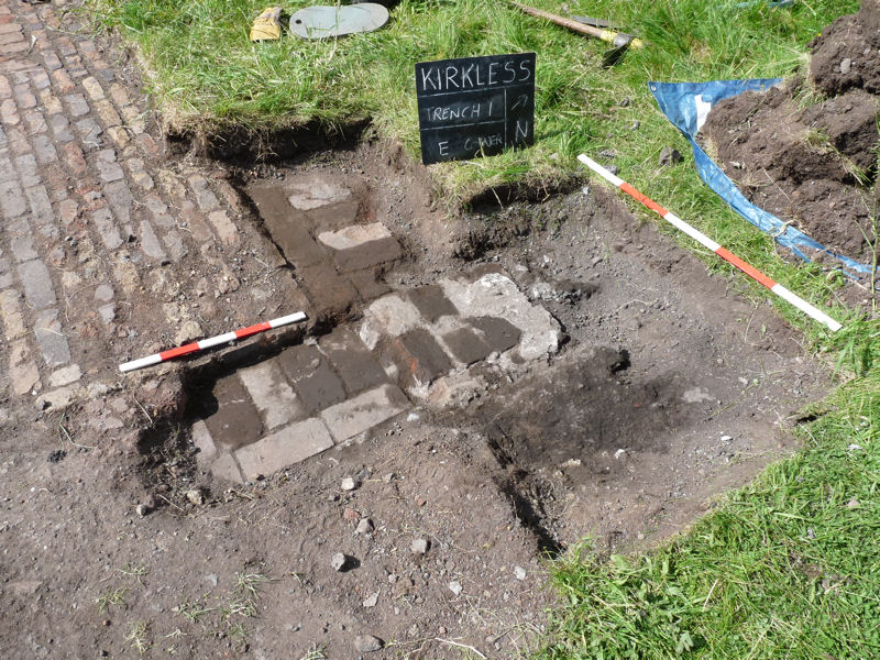 Some of the bricks in the wall on the northeast side of the pavement where found to have an inscription stamped into them.
 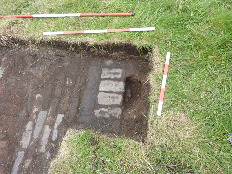 Intially this was difficult to read but later turned out to be GLENBOIG.
 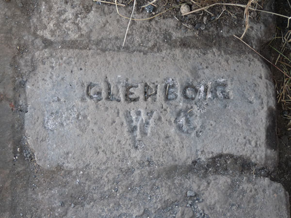 The Glenboig Union Fireclay Co. Ltd operated in the mid 19th century producing world renown fire bricks and refractory ceramics from their factory in North Lanarkshire. This is more evidence that this building was constructed from reused furnace material.
Date: 30th May 2015
With quite a good turnout today (myself, Ken and Andy with Patrick and Eric joining in the afternoon) we were able to make some good progress. However as we uncover more of the brick pavement, the more complex it seems to get. It‘s clear though that this pavement feature represents a standalone platform, as it is surrounded on three sides by brick walls with perhaps an entrances on the southeast and northwest sides. 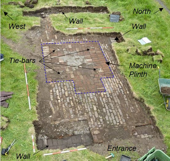 One suggestion is that it was a loading bay. It seems apparent that the bricks in the middle, which are laid flat, form a plinth, designed to support a piece of heavy machinery such as a jib crane. The remnants of large iron tie-bolts support this theory. The bricks here are much stronger than the surrounding bricks which are laid edge on. These are reused firebricks which are capable of withstanding heat but not good for load bearing (although handy for laying a pavement). The walls on the northwest and southeast sides both project in a southwest direction beyond the extent of the plinth (but how far, we have yet to see). Don’t know how high the original walls were but at a later date they were taken down and in the south corner, covered with a thin layer of concrete/ hardcore mix. Concrete also extended from the southeast-ward perhaps forming the floor of the factory.
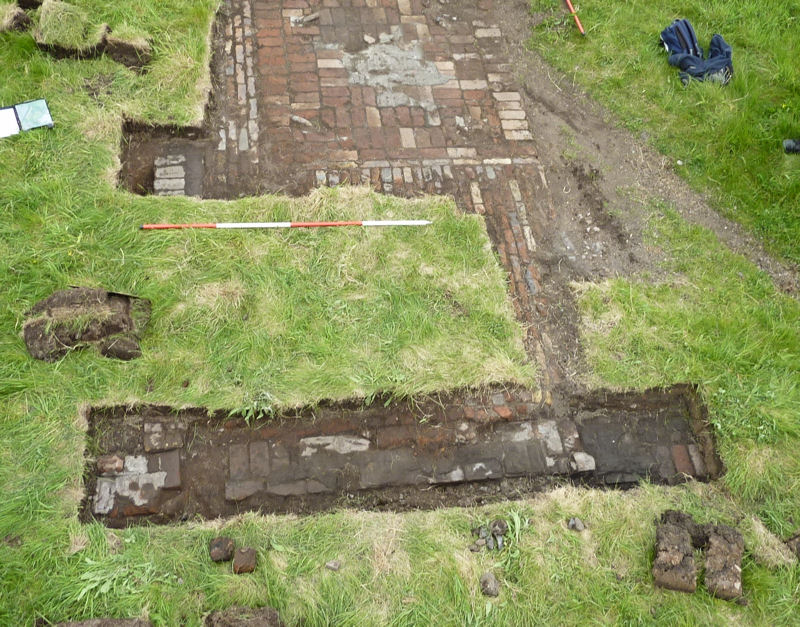 The wall on the northwest side was found to have a wider foundation course and at the north end had a detached plinth. Further excavations will hopefully reveal more.
Date: 17th May 2015
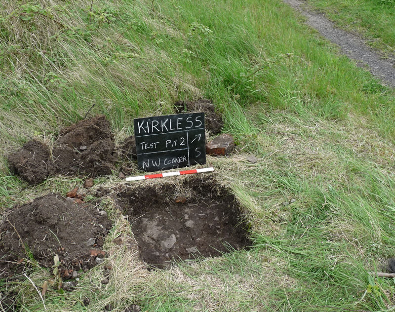
Just four of us to start with this week (Darren, Andy, Ken and myself) but Patrick and Neil (with his sore ankle) joined us in the afternoon. Darren and Ken concentrated on the brick pavement while Andy and I endeavoured to find the northwest end of the southwest wall. This proved to be quite difficult as the overburden was getting deeper the further west we went. Eventually we decided to jump a meter or so to a point where the ground fell away. It was obvious here that the wall must end and sure enough our test pit revealed a termination of the concrete. It wasn’t straight forward however as the end of the wall had broken away digging further west proved that the wall did not continue any further. 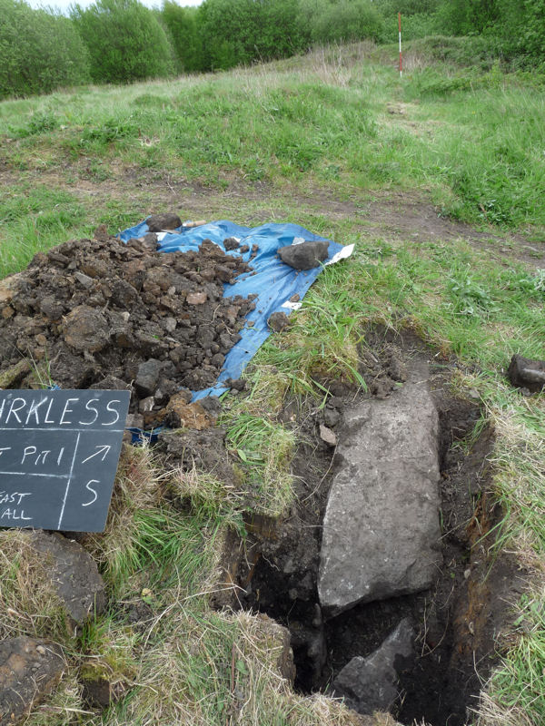
Meanwhile Darren and Ken (and later Patrick) were busy uncovering more of the pavement giving the later brick fill area more definition. They also began to show that in the four corners of the brick fill area were the cut-off stubs of iron tie-bars. This suggests some large machinery or structure may have originally occupied this position. The surface of the later brick fill area also showed signs of mortar indicating that a later structure was located here.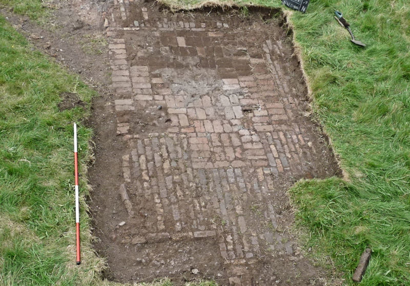 To check the extent of the pavement towards the north east Patrick opened a test pit on the other side of the path. Although there was no brick pavement there was a had surface, perhaps the base for the pavement with the bricks having been removed (a dumpy level check would confirm this).
We also extended the main trench (trench 1) north eastward to see if we could find the extent of the pavement in that direction. We reached what appeared to be a termination but we’ll need to extend the trench t confirm it.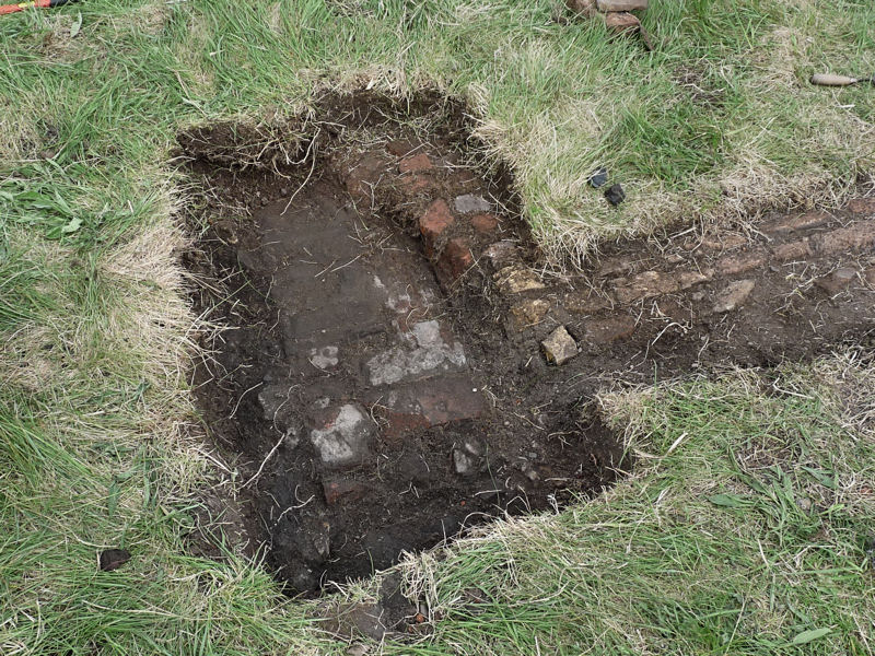
Date: 26th April 2015
On site for about 10.00am for our first dig on the site of Kirkless Steelworks. Just 6 of us today (Shaun, Andy, Christine, Darren, myself and Patrick who joined later). After reading and signing the risk assessment form, we set about uncovering what we understood to be the remains of the steelworks. Christine and Darren were given the job of looking at the brick pavement on the north west side of the site, while Andy and Shaun were tasked with uncovering the south west wall which we surveyed last visit. This proved to be quite a challenge due to the dense undergrowth of bramble on the south side, however Shaun made good progress with his machete and even discovered the stub ends of the buildings stanchions on the inside (north side) of the concrete wall. Andy also found it heavy going at the other end of the wall because of the thick layer of compacted sods it was buried under.
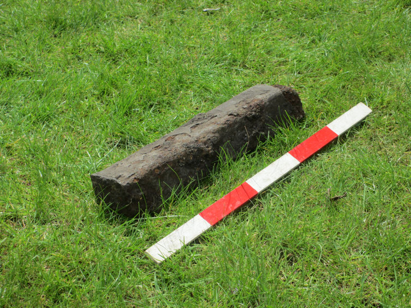
In the meantime Christine was also struggling with the sods overlaying the brick pavement, but it was already clear that there were two styles at this location. This seems to indicate two stages, the earliest nearest the camera (presumably as its toward the centre of the building). These bricks have been laid end on and have a glazed surface suggesting reuse, perhaps from a former furnace. The later bricks seem to be infilling a gap and are made from plain red bricks laid flat.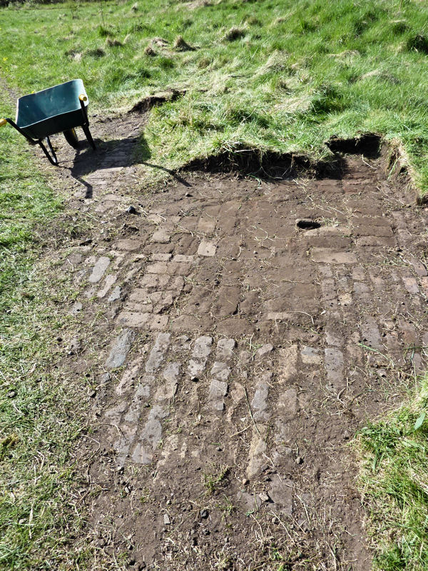 Around about dinner time we uncovered our first significant find. Darren had been probing to the NW of the pavement to see if he could locate the extent of if, digging small test pits to check if his probe hit anything. Instead of the pavement however he happened upon a large iron bar (7cm x 6cm x 38cm ). This was very much like the bars shown in the photographs of the interior of the steelworks – more likely to be a cast billet from the blast furnace delivered to the steelworks for remelting in the open heath furnaces. Quite a nice find – bringing the activities on the site much closer to us.
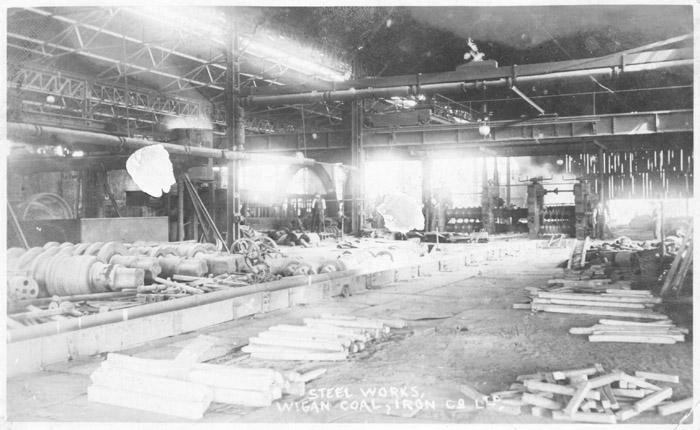 (Image courtesy of WiganWorld)
Throughout the day we had visitors asking what we were up to including a party brought round by Mark Champion as part of a Open Day guided tour of the site. The Open Day had been arranged to celebrate the official designation of the site as a Local Nature Reserve which includes areas on both sides of the canal. All in all the day day was a great success with many people interested in the site and what we were doing. Hopefully this will encourage more volunteers.
Date: 11th April 2015
Last year we presented our Project Plan to the Council for their approval. Last month our ‘Licence to Dig’ finally arrived and, with our Insurance now in place, we are ready to start the project. With this in mind, last Saturday we met once again with Mark Champion and Sue Lonsdale from the Wildlife Trust and some members of the Friends of Kirkless. The idea was to go over the site and identify areas where we could do the work (with such a sensitive site, it was important to make this clear). Mark, however, seemed to be more flexible (although he did say he indented being around when we start so he might change his mind when the flowers start to appear).
We also took the opportunity to start surveying some of the features that are already visible (we are using the Iron Block as our datum point).
The surveyed features are in green and, as you can see, the bottom wall isn’t that far off – the next wall is actually spot on (although not the wall we thought it was). The pavement though (top left) doesn’t make a lot of sense yet.
We’re planning our next visit for Sunday 26rh April when we will be starting excavating.
Date: 6th June 2014
We met with Mark Champion today on site to look at the areas we plan to do some work and to discuss guiding principles for our excavations. Mark said he needed to be sure there would be minimum impact on sensitive areas. However he said he would be happy to leave the selection of specific areas to us as long as we avoiding digging where the vegetation is thin or where there is a range of species growing. Mark indicated he would allow some flexibility but would need to be consulted before we commenced. Also any spoil from the excavations would need to be placed on sheeting so that it can be retained for back-filling, or, if a feature is to be left exposed, then the soil can be dispersed in discreet locations on the site.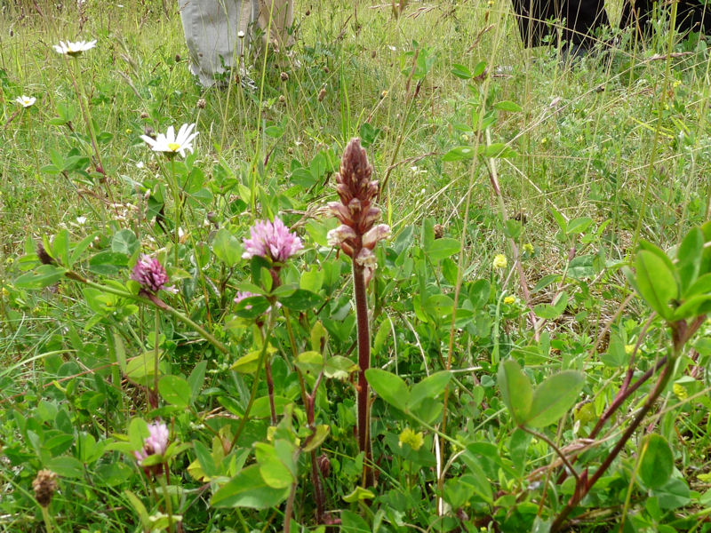 This Broomrape is one of the rare species found on the site (it’s a parasitic species in that it has no Chlorophyll relaying entirely on its host plant for nutrients). Mark said that in itself it wasn’t particularly rare but the total assemblage of species was remarkable for this part of the country.
A soon as I get chance I will put together a project plan for the work which Mark will be able to present to Wigan Council who have final say on what we can do.
Date: 30th March 2014
Another great day for our site visit. On our previous visit we had used both the theodolite and modified dumpy level at each of our two stations to obtain duplicate results which we could then compare for accuracy. The results, as you can see, match pretty well and now we have a revise the overlay drawing with some confidence in its accuracy.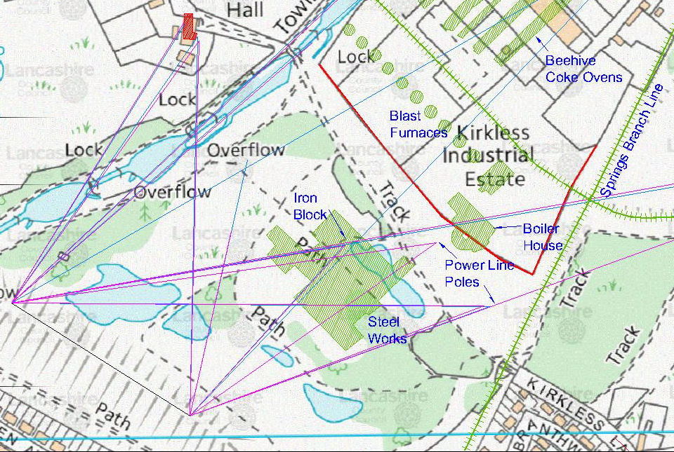 We used it to produce a reverse surveying map which we now intended to use to pinpoint the location of the Steel Works.
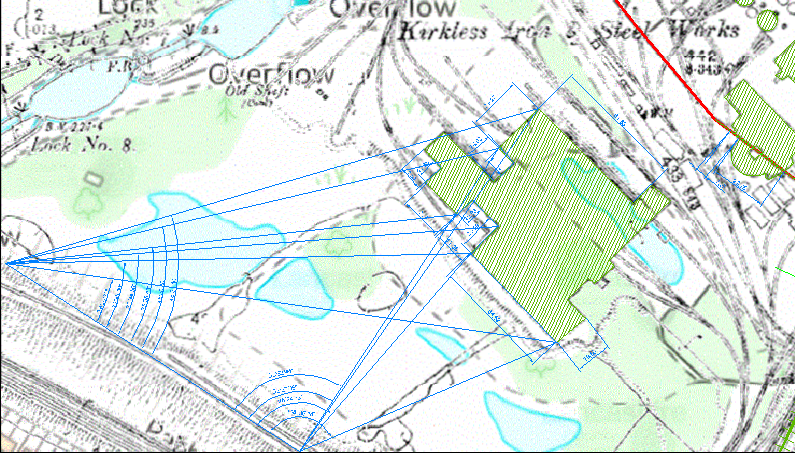 We thus set up our devices on our two stations, theodolite on the right and the dumpy on the left – manned by Neil and Andy respectively. The rest of us (me, Patrick and Dave North) set off to wonder about in the field with ranging poles trying to obeying instructions in an attempt to find the correct alignments. We had added letters to each point of the steel works shown and we tried to locate each one in turn.
This turned out not to be as easy as it had seemed on paper as trees and humps and hollows were set to thwart us at every turn. Eventually, however, we managed to locate most of the points around the steel works and lo and behold walling and brick pavement seemed to line up with our points. For the first time we will be able to say for certain what all the humps, bumps and bits of walls in the landscape are. We now need to produce a project plan to determine where excavations would be fruitful.
Before we left, Dave and I went over to where the boiler house was indicated on the map. It soon became apparent however that excavation here would be very difficult as there appeared to be large amounts of dumped material – and where the original ground level did appear, it seemed to be made up of demolition debris – so probably best to stick with the steel works site.
Date: 9th March 2014
First chance to get out to the site after all the rain we’ve had this year – and it turned out to be a beautiful day (quite different than this time last year when our first attempt had to be abandoned due to the cold). Repeating the survey we finally managed last year but this time using the plane table with a modified dumpy level (the alidade worked but because the distance were so great, accuracy wasn’t as good). The modified dumpy swiveled on a plastic plug at the datum point and a pointer attached at the front gave us the positions in a similar way as the alidade. 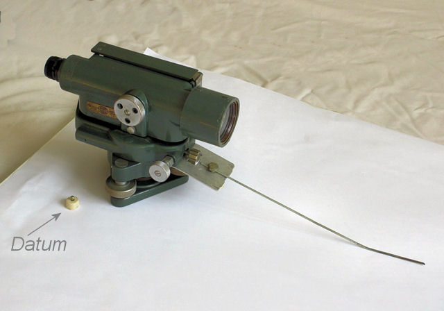 We needed to get the survey done before the vegetation starts to grow back and our sight lines start to disappear. To be doubly sure, Neil brought his theodolite so we were able to double up on the readings.
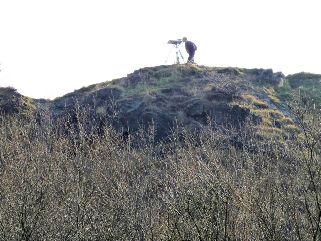
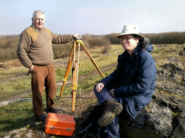 The most difficult thing was being able to spot the same thing from both positions on Rabbit Rocks – Kirkless Hall from behind the trees could only be seen in parts and the canal bridge could only be seen fro the left hand station (despite using the extended surveyors staff with an extra piece on top).
  The results from the survey will give us more confidence in locating the features of the steel works which we need to produce our project plan.
Date: 27th September 2013
Met on site with Mark Champion from the Lancashire Wild Life Trust. The purpose was to discuss the possibilities of further work following on from the survey we carried out in April. As we walked over the site, Mark was keen to point out some of the unique features in the landscape which had developed due to its past industrial activity. Slag from the blast furnaces has produced an alkaline-rich soil. This, together with the slightly saline coal waste, has resulted in a habitat that is reminiscent of remote areas of the south coast of Britain. Grasses normally found on seaside dunes, water plants not native to these parts and rare flowers, all make this quite a remarkable landscape.
However Mark was not averse to us carrying out some excavation. He highlighted a number of areas where he thought digging would do little or no damage to the ecology. In fact Mark was quite keen in trying to understand the site himself. The next thing we need to do is to develop a project plan to present to the council (the present land owner). Mark thinks that with his approval, getting permission should not be a problem. It would be quite something for us to uncover structures from this site which has such a significant industrial heritage.
Date: 7th April 2013
This was our second site visit (an earlier attempt the last week was abandoned due to the bitterly cold weather). This time we were able to establish two stations on Rabbit Rocks 200 metres apart. Using our new plane table surveying equipment, we proceeded to survey various features in the landscape.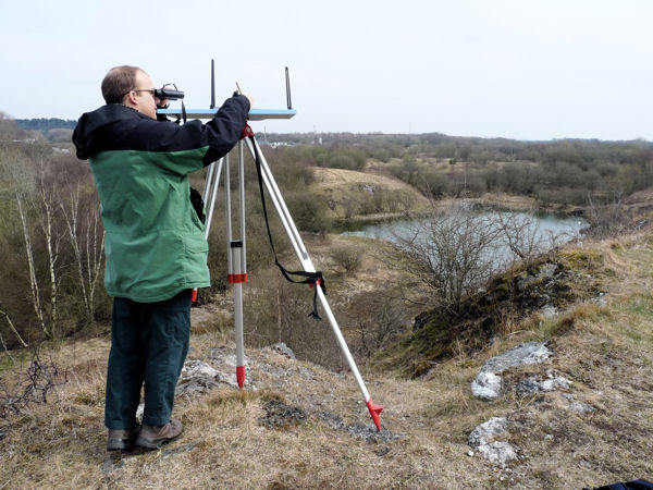 The first features were specifically selected as reference points that could be identified on the map. They included the canal bridge, Kirkless Hall itself, the east corner of the industrial estate fence and some building inside the industrial estate – all of which could be later used to key in our survey. The corner of the fence was particularly challenging as it could not be seen directly – Eric was able to improvise using an extended survey staff with an orange plastic bag on top which could just be see above the trees – on a site as large as this, binoculars and walkie-talkies proving to be invaluable.We also recorded some features of the old works that still survive in the survey area i.e some stone blocks, a brick floor and a massive 2 metre high lump of iron and brick. This peculiar feature seems to have been cast inside a brick room, leaving behind the impression of the walls of the room behind. The next stage is to overlay a map with the iron works on it so that we should be able to pin-point exactly where it was located in the current landscape.
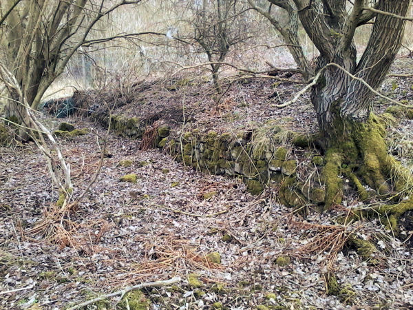
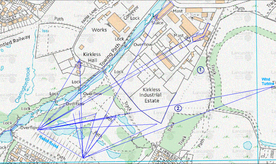 Finish off the day by walking over other areas, outside our survey area to see what features have survived. To the east of the the main site there were two reservoirs which have been back filled. A cutting marks the course of a rail line running round the top edge of the northern one – it’s marked out by this stone wall (1. on the map above).
 The Springs Branch line once ran northwards in a cutting between the main site and the reservoirs. Little of it survives – except perhaps the remains of the brick bridge abutment where a line called the Round House Branch crossed over it (2. on the map above).
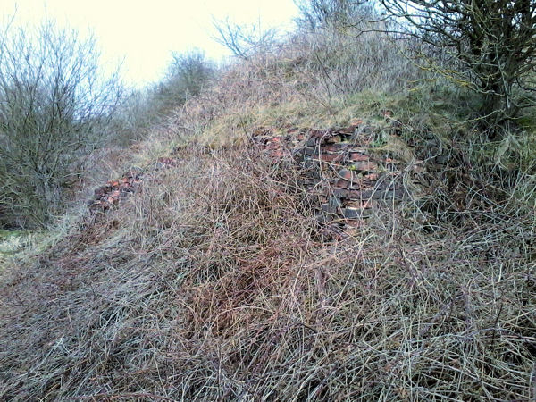 This line ran behind the blast furnaces before crossing the canal and looping round to eventually join the Whelley Loop line.

Hi, I believe my great grandfather may have worked as a Metal Carrier at the Kirkless site. I am visiting the area to try and find his grave this weekend and would like to visit the site of the iron works. I’m having trouble tracking down exactly where I should go though. Could you possibly give me any directions?
Thanks
hello
i was brought up in the ince area and know the area very well from manchester road to as far as top lock i lived with my great Grandad who worked at top place and then moved to irlam steel works when top place closed we use to go for walks over the site of the old steel works and he would explain to me were everthing used to be including the position of the big chimney that when constructed had over one and a half million bricks and seventy tons of steel banding around it the base as far as i know still remains it was not removed during demolition
Hi Antony – It would be great if we could meet up sometime to see if we could pinpoint some of the places your great Grandad told you about. Please let me know if this would be possible.
Bill Aldridge (secretary)
Wigan Arch Soc
ooooooo I have been up there the place of my birth many times as I had the most wonderfull child hood I have been all round but not to top place I would love to explore it though I love that place think we will go and look next week I didn’t know all this was going on how exiting x
I am very interested in the local history of Wigan.
I was literally born in Higher Ince and PLAYED all over this site when I was a boyin the 1960`s.
Apt I suppose as my Great Grandfather William FENNELL WORKED at the Iron and Steel Works around 1901.
My great Grandfather fell into the top of the INCE Blast Furnace around 1860-70.
I was hoping for details of the plant location. I have a handed down photo of the works
Dear Neville, we have heard of a number of terrible accidents at the works – it’s difficult to image how bad the conditions must have been for the men working there . The blast furnaces were located further to the north of the site we are currently working on – they lay within the bounds of the current industrial estate which is beyond our access. We would really like to see the photo you mention – maybe you could send a copy to this address b.aldridge@blueyonder.co.uk (I can send a map of the site in return).
Cheers,
Bill Aldridge (secretary)
Hi There,
I live in Wigan (Aspull) and my company is based in Westhoughton, we are the Uk Distributor and training provider of the Mala GPR (Ground Penetrating Radar) system in the UK.
If our kit or services are of any interest to you let me know.
pete@sygma-solutions.com
Anything we could do to help with local projects like this, loan of GPR kit or training etc would be a pleasure and of course free of charge.
Hi Peter,
This sounds fantastic – we have resistivity equipment but is no use on the present sites we are looking at. We’ve thought about GPR but imagine it to be outside our budget. Kirkless is typical of industrial sites which tend to be a mix of brick, concrete structures and demolition rubble. If your equipment can distinguish between all this mess your help would be very much appreciated.
Bill Aldridge (secretary)
Hello. In the 1970’s my friend and I were members of a local society that preserved industrial steam machinery. We became quite interested in collieries and then later discovered Kirkless Ironworks. In 1975 I copied some photos that existed in Wigan Library of the works and we also did a few photos of what remained at the site. Would any of these be of interest? We had intended to study it all in more detail but other things took over. We did interview a couple of people who had worked there or knew it well and hopefully this information is still here somewhere.
Hi Chris – this sounds very interesting. I’m currently writing the project up so any information or photos would very welcome and gratefully received (I will of course credit the source if used in the final report). My e-mail is bill@wiganarchsoc.co.uk – cheers.
Hi.
I have stumbled upon this account of your explorations of the Kirkless Site.
I was born in Kirkless Lane, at number 6, in 1941 ( now 78 yrs).
As boys we played all over the old workings. I left the area with my job in 1961.
I particularly remember the Water Softeners near to your Big Chimney site, as I accidentally fell into one and was rescued by friend. I can recall exploring the base of the demolished big chimney, by climbing over the rubble. The blackened inner surface of the chimney base was a surprise to us kids.
In the 1950’s my mother worked as an office cleaner at the ‘Top Place’ during the evenings and the group of women used to walk alongside the railway from the offices to the Kirkless lane railway bridge. They passed the chimney ruins and the Water softeners, twice a day.
Bob Bootle – Apologies, I have a correction to my comment above.
I have been looking at your maps and photos of the Kirkless project. and I now think that I was wrong about my early experience in the rubble of a chimney near to the Water Softeners, In my memory the rubble that I entered was not the big chimney base because we were further up the railway line, nearer to one of the old coking oven sites.
Hi Bill
Finally found your email reply of 2015, thanks
I will attach the info I have gathered for you to your email
my best email is ssheg@hotmail.com
Thanks
Dr Neville Hodkinson PhD
SSHEG