Last Sunday, despite the wind and rain, three brave members of our Society (plus Debbie the dog) ventured up on Heapey Fold Lane to see if they could find where Chorley Society excavated in the early 1960’s. Overlooking the Anglezarke reservoirs, this track is thought by many to be the Roman road to Ribchester (you can see more details of the trip here…).
Category Archives: Site Visits
More Toddington Lane Activity
Just when we though we had finished our work on this site more features turn up (see the details here).
August Trip
Sunday 20th August. Ian Trumble has kindly arranged for us to visit Hall i’th Wood and Smithills Hall – both grade I listed buildings on the outskirts of Bolton. Please contact me direct on bill@wiganarchsoc.co.uk if you interested in going.
Hall i’th Wood is 16th century and famous for being the home of Samuel Crompton, who invented of the Spinning Mule. The oldest part of Smithill’s Hall dates to the early 14th century and was probably moated.
Ian will be opening Hall i’th Wood specifically for us in the morning but for Smithill’s Hall we will be joining a regular tour in the afternoon. Ian is also seeing if he can get us access to the Bolton Museum archive store which has over a million items in store.
Orkney Trip
Some more photos of our recent trip to the Orkneys here
Toddington Lane Activity
Over the last few weeks there has been much activity at our Toddington Lane site (Mrs Pendlebury’s Milestone), including the GM Festival of Archaeology where volunteers from the general public were invited to join in. We’ve even had 3D models made of our trenches, kindly produced by one of our volunteers, Lee McStein, who is a specialist with this sort of thing (3D-Trench 1 – 3D-Trench 3).
Mrs Pendlebury’s Milestone Excavations
This month we have started excavating this roadside stone which Mrs Pendlebury is convinced is Roman. Her reason for thinking this is that it lies near where she lives in Haigh on Toddington Lane which is thought to be the Roman Road from Wigan to Ribchester. You can see the reason for thinking this here. The stone, which was broken a few years ago by an excavator, is obviously not Roman and may not even be a milestone, but what exactly is it. You can follow our progress finding out what it is here.
Summer Trip (Lancaster)
Great turn out last Sunday for our trip to Lancaster, this year supplemented by a contingent from the Wyre Group and a group of friends from the Bolton Society (more details here).
Borsdane Wood Trip
After some rearranging, we managed to get Trevor Boardman to take us out last month on a short tour of Borsdane Wood. Trevor had previously mentioned that there were some strange and puzzling features in the wood that perhaps we weren’t aware of and maybe we could suggest an explanation for. Having grown up in Hindley, I thought there was little I didn’t know about the wood and I was therefore intrigued and perhaps a little sceptical about what Trevor was claiming.As our group assembled at the Hindley end of the wood in front of the tunnels, Trevor immediately began to tell us what he thought of them. Controversially he was suggesting that far from being the masterpiece of Victorian engineering we all admired, it was a botch job in his opinion with changes of design having to be made throughout its construction.
His first evidence was the capping stones running along the top of the entrance’s parapet. On the right side the stones curve round to form a smooth interface with the side wall. On the left side however the stones abruptly disappear behind the huge stone buttress. Trevor suggests this wall had to be added at a later date to prevent the steep embankment from collapsing the brick parapet. He also suggests that the second huge stone buttress was added between the tunnels once again to shore up the brick wall in the centre of the two tunnels. It is true that these buttresses are not integrated into the wall but lie up against it.
(View of the tunnels from the late 70’s.)
Trevor’s second piece of evidence was the arrangement of brick buttresses which span down the length of the river tunnel keeping the walls apart. These are irregular in width and position suggests they were added later perhaps when realising the walls needed shoring, perhaps replacing temporary wood baulks put in as the tunnel built up. Trevor reasons that a tunnel this high would normally be a figure of eight design or perhaps a series of arches on top of each other as the Romans did with their aqueducts. This arrangement looks like they just hadn’t thought it through.
Lastly Trevor pointed to the wall on the wood side of the tunnel with its irregular construction again suggest changes during the building phase. This time the parapet wall and buttresses are made from blue engineering brick which is stronger and more water resistant. The left hand buttress has horizontal courses whereas the central buttress courses are at 45 degrees. It also looks like the parapet wall has been heightened leaving a row of capping stones in-situ at a lower level.
Not knowing the full history of its construction it’s difficult to say whether Trevor is right, maybe the tunnel was extended on this side at a later date to accommodate an extra line. I do know that the line was started in 1845 and initially called the Liverpool and Bury Railway. By the time it was finished in 1848 it had changed its name to the Lancashire and Yorkshire Railway. Whether you agree with Trevor or not the tunnels seem to me to be quite a feat of engineering for their day and still in working condition after 170 years.Next Trevor took us to look at the site of the cotton mill that was demolished soon after the turn of the 19th century. In its day it had both water and steam power with a large mill pond to the north which is still evident. The mill site itself if completely overgrown but I remember an excavation there in the mid 60’s carried out I think by pupils from Argyll Street School. They uncovered huge stone machine beds which I presume are still there but may well be buried under wash from the adjacent hillside.
6 inch OS map of 1849
Trevor was keen to explain how the mill pond was fed with water and so a little further into the wood he showed us the remains of the leat or race leading off to the north of the pond. However as this ditch approaches the path it disappears, so where did the water come from? Trevor took us along the path to a culvert passed under the footpath taking water from a small valley leading off to the left. He told us to examine the small valley and see if we could spot anything. Sure enough in the stream bed were loose bricks and little further up we could see the source, the remains of a brick-lined culvert, the head of which was the remains of a small dam. Trevor’s contention is that this stream was the source of the water for the mill pond. This seems quite feasible as the stream actually comes all the way from Hall Lane where there is a reservoir in the grounds of Hindley Hall. Trevor says this was used to store water ready to fill the mill pond when needed.
I was quite surprised by this as I always thought that the water came from Borsdane Brook as there is the weir at a place we always referred to as Flag Bottom. However how the water got from the weir to the mill pond is not very obvious and landscaping in the 80’s has made it impossible to find out.
The 6 inch OS map of 1849 however does show the leat going all the way back to the weir, albeit through a tunnel. I seem to remember the entrance to a square shaped stone-lined tunnel on the west bank of the Brook but all traces have now disappeared due to the landscaping. The OS map shows Trevor’s stream running into the leat as well as a stream from the opposite bank. It seems obvious therefore that the mill pond was fed by a sophisticated water management system designed to maintain a constant supply which is need to keep the mill wheels working through all weather conditions.
The last site Trevor took us to was located on the other side of the Brook where the trees open up into a clearing of level ground. As a child I played in this field many times but never spotted the next think Trevor pointed out to us. Running the full length of the field from north to south we could see parallel ditches approximately 4.5 metres apart. The field is not as clear as I remember it and was probably completely devoid of trees not that long ago. The ditches seem to be part of some field system but I’ve no idea what age. Medieval ridge and furrow is quite rare in this part of the country and usually has a slight ‘S’ shaped curve to it.
These ditches are completely straight with little or no ridge in between. Very similar field systems can be seen in other parts of our region. In fact when investigating the line of the Roman road in Standish we came across exactly the same pattern in fields between Wakefield’s Farm and Roundmoor farm.
This was a great trip and Trevor has certainly left us with some interesting questions which hopefully we’ll be able to answer in the near future.
Row High Wood – Site Visit
Last year David Ratledge gave the Society a talk on recent discoveries he had made using LiDAR imaging. Of particular interest to us was this image of what he suggests is the Roman road between Coppull and Charnock Richard. It crosses a field called Row High Wood (see below) and looked quite promising so we thought we better have a look (more details here).
GPR Training Day
As mentioned in our recent Newsletter Sygma Solutions, who are based in Westhoughton, have offered the use of their Ground Penetrating Radar machines to survey local heritage sites. This includes free training, so last Monday a team of 5 (myself, Eric, Neil, Darren and Andy) went to their office in Daisy Hill for a morning’s training session. We were met by Mike Langton, who is not only their chief trainer but also teaches GPR to archaeological students at Bradford University (in fact he has appear on a number Time Team episode). He explained that the course normally took 3 days but as we were already familiar with geophysic techniques, our abridged course should be sufficient. The machines they are making available for us, use the latest technology and are capable of producing 3D images in the field. Additionally, if necessary, the data can be downloaded and they will ‘post-process’ it for us with their sophisticated software.
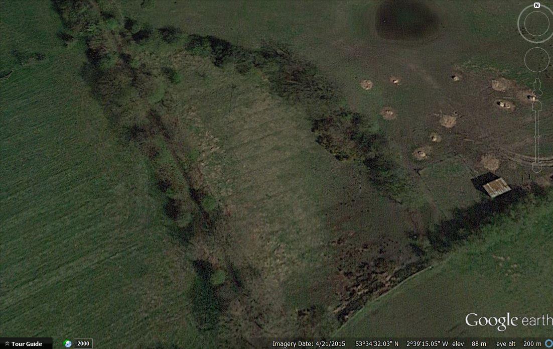
After lunch, with the knowledge gained, we made our way to Haigh Hall where we had previously obtained permission to carry out a demonstration of the equipment. The area selected was on the terrace between the Stables Cafe and the Hall.
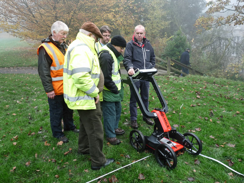
Mike explained that the unit is capable of ‘seeing’ up to 8 metres deep depending on ground conditions but in general 2.5 metres gives best result. After some general prospecting Mike showed us how to mark out a 10m x 10m grid and proceeded to carry out the survey (readings are taken every 5cm with scan run spacing of 50cm).
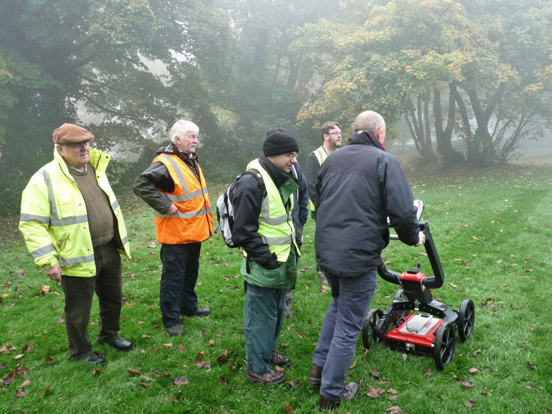
After a while he left us to it and we completed the survey (which included a second scan at 90 degrees to the first) in about an hour.
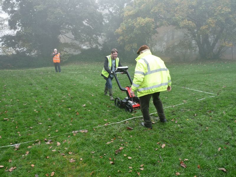
The reason we had selected this particular area for the survey was that a desk-based assessment done by the GMAU a few years ago had indicated buildings here prior the building of the Stable block in the mid 19th century – and indeed the results showed structural remains at various depths from 30cms to just over a metre. The scan shown below is at 90cm, which was typical with a strong feature (maybe a wall) running at an angle to our gridlines and a structural feature running perpendicular to it.
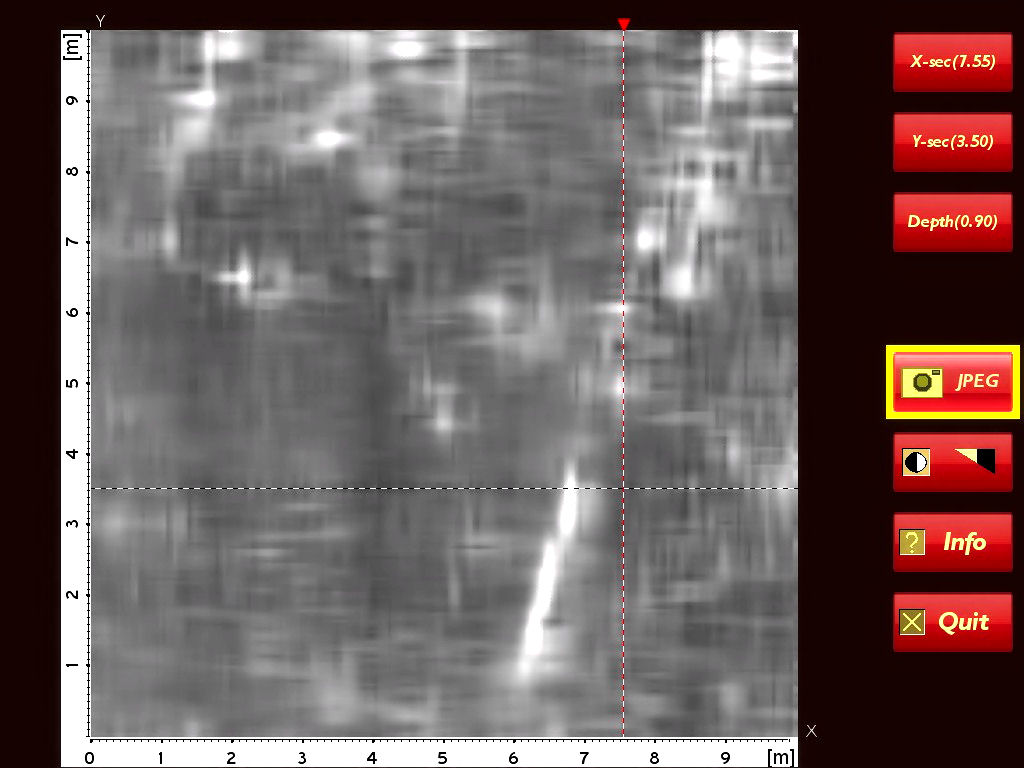
We are now quite familiar with the equipment and, given the opportunity, we would be able to complete a full survey of the area. This would give us a comprehensive picture of the archaeology in a area which maybe subject to development in the near future. We would like to thank Peter Ashcroft of Sygma Solutions for organising the day and Wigan Council for allowing us on site.
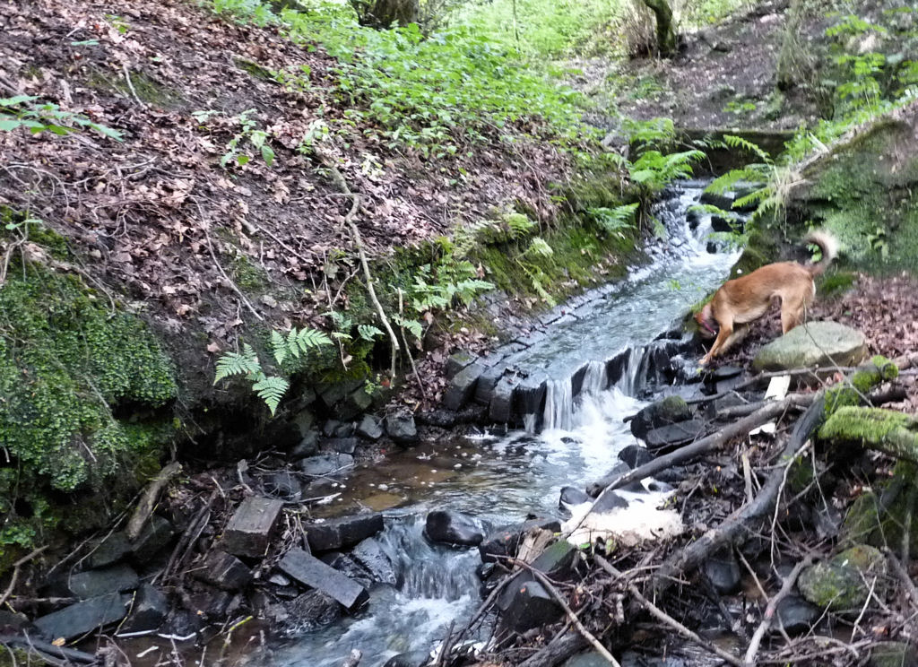
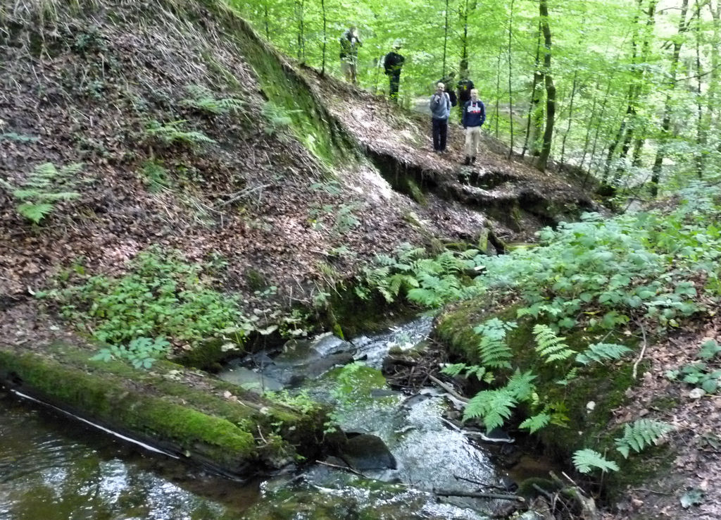
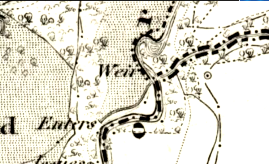
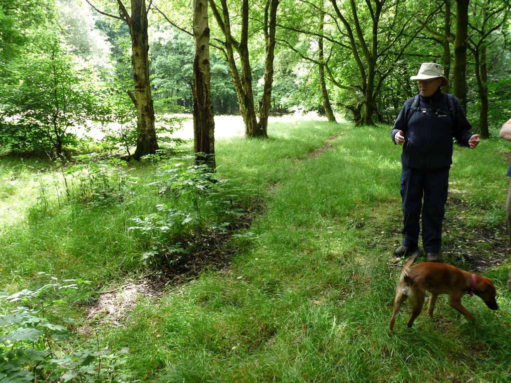
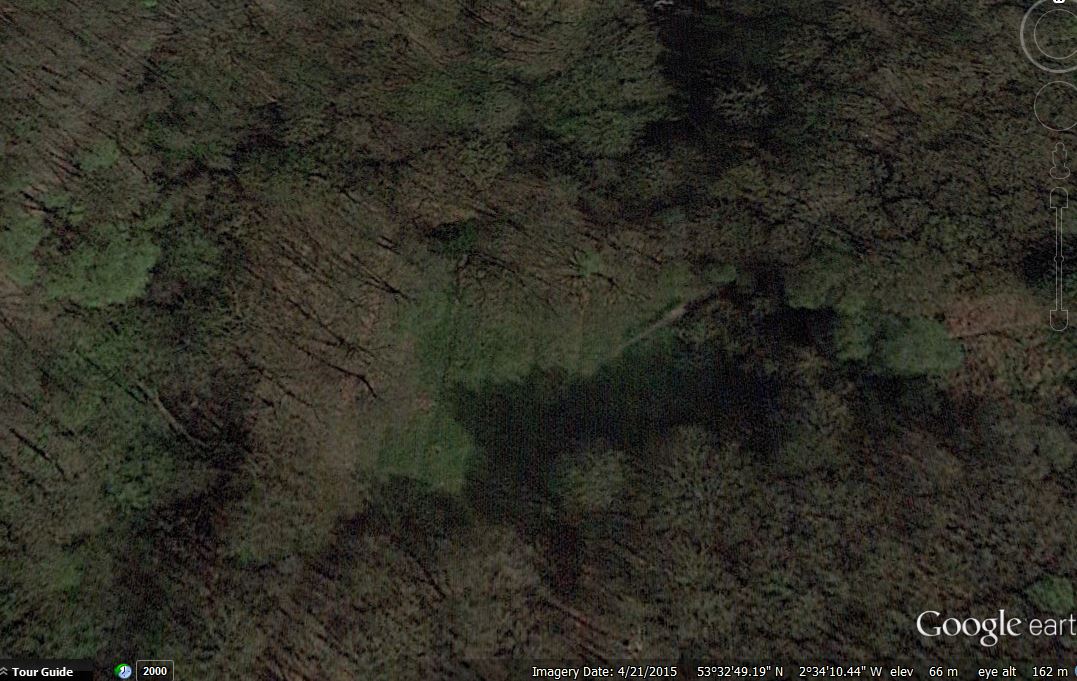
While on site we were join by Patrick and after the survey he suggested we take a look at some ruins he’d spot alongside the path leading into the plantations (maybe it was the reputed summer house shown on early paintings and engravings)
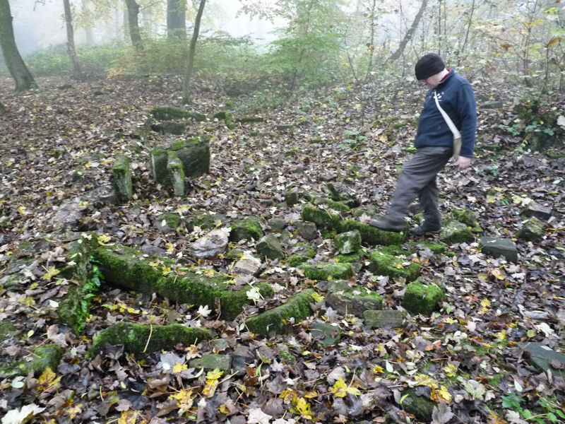
A tape measure showed the remains to cover an area over 15 metres long (50 feet) with features such as stone window frames and stone box structures. On the OS map of 1893 the ruins are marked as Park Cottages – they are also shown on the 18th century estate map therefore must be of some age. The suggestion is that they would make a good subject for a future surveying project.